God’s Eye View

God’s Eye View

Ivan Melchor (research assistant)

VizE Lab for Ethnographic Data Visualization, Anthropology

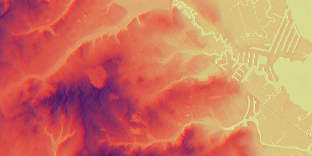
Relative elevation models (REMs) are constructed by normalizing raster datasets to the elevation of a particular water channel and then exaggerating the lower elevation values to enhance the visualization in ArcGIS mapping and analysis software. In the case of this area off the New Jersey Coast, the model shows the contrast between fluvial landforms formed over thousands of years by the ocean and man-made processes. This is part of a larger project with the Department of Anthropology and the VizE Lab that seeks to use data analysis and data visualizations to understand the processes through which the concept of the “resident” is privileged above that of the “community” and how private property acts upon community-wide flood risk.
Mountain Lee Wave Clouds at Sunrise at Coronation Island

Mountain Lee Wave Clouds at Sunrise at Coronation Island

Sonya Legg (senior research oceanographer), Stephen Griffies (faculty)

Atmospheric and Oceanic Sciences Program

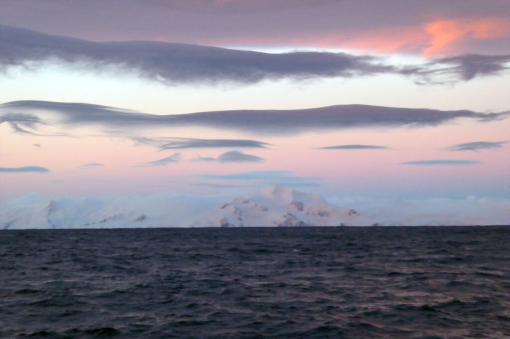
Viewed from the deck of an ocean research ship in the Scotia Sea, north of Antarctica, the sunrise illuminates a series of elongated clouds, each of which is at the crest of an otherwise invisible wave in the atmosphere downstream of the mountain range visible on the horizon. The winds push the air up over the mountains, and then down on the other side, producing a series of undulations known as “lee waves.” At the top of each undulation, the temperatures are cool enough to condense the moisture in the air, producing clouds. The goal of our ocean observational program was to measure similar lee waves in the deep ocean produced by ocean currents flowing over underwater ridges, and other small-scale and turbulent ocean phenomena. The deep mixing in these dense ocean currents flowing into the Scotia Sea through the Orkney Passage determines the properties of the Antarctic bottom water, which fills much of the global abyssal ocean. Measurements on an ocean research ship take place around the clock and beautiful sunrises are one of the rewards of working the night watch.

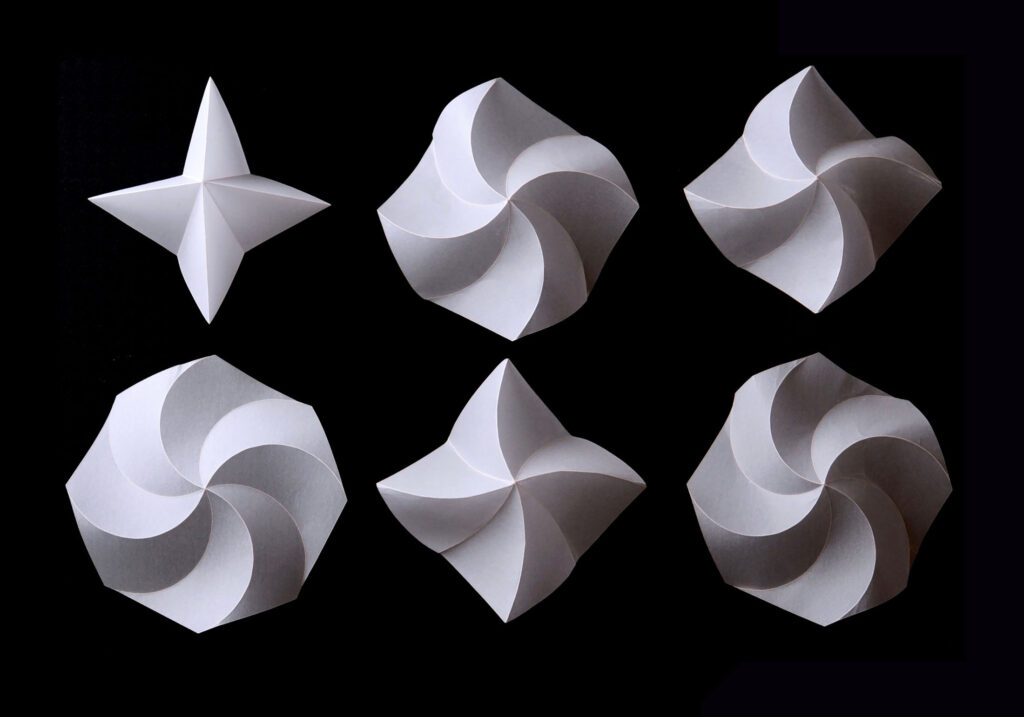
Curved Folds

Curved Folds

Lucia Stein-Montalvo (postdoctoral research associate), Jessica Flores (graduate alum ‘21), Sigrid Adriaenssens (faculty)

Civil and Environmental Engineering

Origami, the ancient Japanese art of paper folding, is most often made with straight creases. When creases are curved instead, panels bend during folding, resulting in elegant forms that are also functional. Curved-crease origami can be used in engineering and architecture, with applications ranging from kinetic façades and deployable furniture to car body design. The structure in this photo, known as the “waterbomb base,” is also bistable, meaning it can quickly switch between two states. Changing the crease curvature tunes the shape and mechanical behavior.

Balancing Act

Balancing Act

Sigrid Adriaenssens (faculty), Axel Larsson (graduate student), Robin Oval (postdoctoral researcher), Orsolya Gaspar (visiting fellow)

Civil and Environmental Engineering

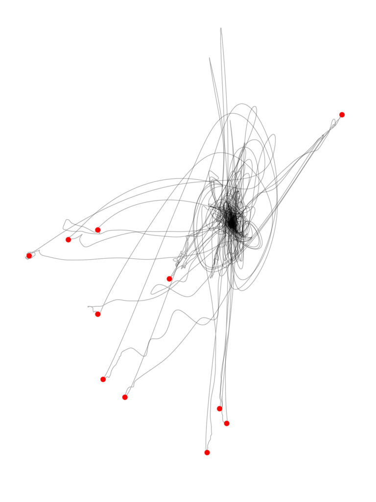
Spatial trajectories of a net node, a connection point in a communications network that is being pulled, released, and returned to its original equilibrium position. We recorded the trajectories using motion capture technology, and marked the release position of the node with a red dot on the resulting graphic. This piece was drawn from the data using a pen plotter, and the circles were inked in by hand.

Two Fish in a Well

Two Fish in a Well

Jeffrey Lee (graduate student), Marvin Cortez (graduate student)

Molecular Biology, High Meadows Environmental Institute; Science, Technology, and Environmental Policy program

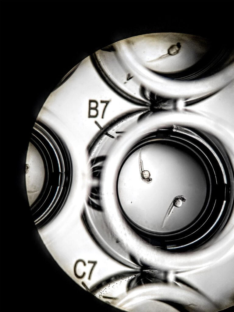
Two zebrafish are resting in tranquility as researchers peer upon their translucent forms. In this particular experiment, we were attempting to use a vertebrate model to examine possible toxic and growth-associated changes that certain human microbiome-derived peptides might exert on a living system. Zebrafish can be used as a relatively low-cost, humane, model organism for determining biological effects when compared to larger and more complex animals such as mice. These zebrafish were raised and initially processed by Marvin Cortez, a graduate student in the Burdine Lab, which maintains a zebrafish population here at Princeton. Peptides used for testing, post exposure monitoring, and image acquisition were handled by Jeffrey Lee from the Donia Lab.

Joshua Tree Trails

Joshua Tree Trails

Shannen Prindle ’23

Mechanical and Aerospace Engineering

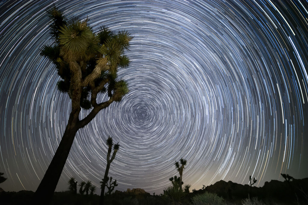
Star trails are a type of astrophotography technique that captures the apparent motion of the stars through long exposure. This photo was taken over the course of one hour along Willow Hole Trail in California’s Joshua Tree National Park. Towards the bottom left of the image, you can see a few streaks from the Perseid meteor shower, as this moment was captured on Aug. 8, 2021, just a few days before the shower peaked.

Life at the Extremes

Life at the Extremes

Luke Maier (graduate student) ’23

School of Public and International Affairs

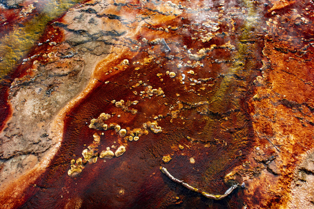
These colorful textures are a bacterial mat living in a highly acidic, near-boiling stream flowing from the Black Pool at the West Thumb Geyser Basin in Yellowstone National Park in Wyoming. Bacteria at the park’s famed geysers live in extreme habitats where no other organisms can survive. Scientists therefore call these tiny tough creatures “extremophiles” or lovers of the extremes. The bacteria pictured here digest chemicals dissolved in the steaming water, which give the bacteria their colorful appearance.

[Henry Horn Award] Fragments

Fragments

Felicia Sanders ’25

Molecular Biology, High Meadows Environmental Institute

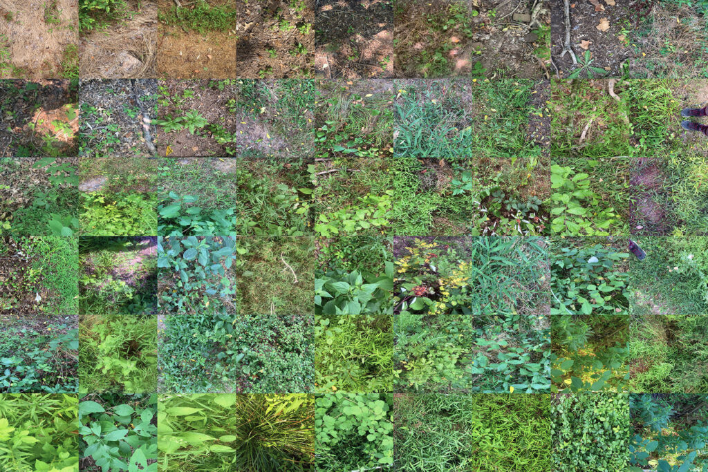
I was an intern last summer at the Billie Johnson Mountain Lakes Nature Preserve in Princeton, New Jersey. My research assessed the ecosystem health of the reserve by inputting the species composition of random plots into a Floristic Quality Index (FQI) Calculator, a tool for monitoring and measuring the health of plant communities. The FQI assigns a score from 1 to 50 to each plot, and the scores are largely correlated with the amount of stewardship work completed. In general, the bottom two rows have been worked on since the project’s inception in 2019, whereas the top two rows only began being managed last summer. This study will ideally be replicated in future years, and the preserve should see both quantitative and visual improvements.

Isolation Chamber

Isolation Chamber

Bumper DeJesus (staff)

Andlinger Center for Energy and the Environment

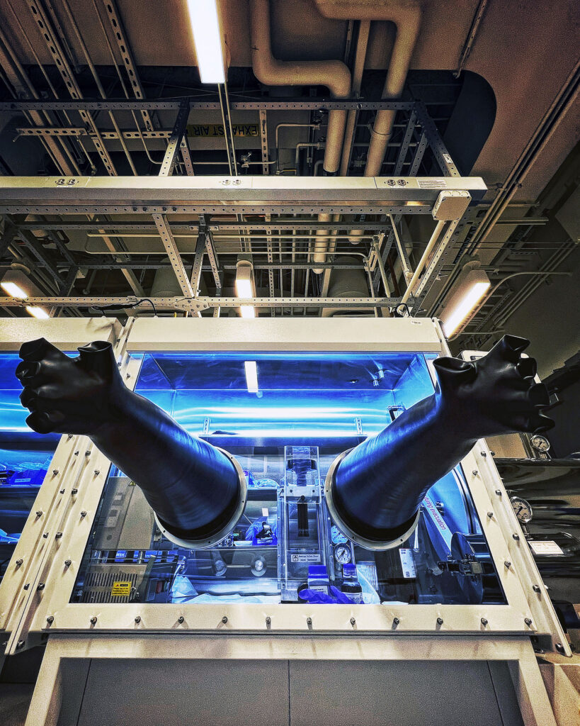
There’s something eerie about an inanimate object that appears to have come alive – especially an enclosure that’s meant to isolate – looking like it’s reaching out for human interaction. I snapped a photo of this glove box in Professor Kelsey Hatzell’s lab as a test shot while I was assisting a campus photographer in determining the room’s available light.

[Honorable Mention] Split Time-Lapse, Lake Carnegie

Split Time-Lapse, Lake Carnegie

June Ho Park ’20

Art and Archeology, Visual Arts

A traditional time-lapse is made by taking a series of images at equal intervals and stringing them in a video. This video is about breaking that process. First, I made a custom black-and-white gradient map, which dictates the shapes and direction of the panels. Then, I used code to split the gradient map into panels and mapped images in the time-lapse to the panels. The resulting time-lapse shows multiple points of the day in each frame.